Tori Abbott, Ray Barron, Jake Bennett, Keleigh Dockens, Fio Fioretti, DJ Gralenski, Cat Isaak, Jason Jacoby, Kevin Jones, Walker Lewis, Austin Mitchell, Nicole Nimmons, Cole Simmons, and Nathan Walker
Megan Cattau – COID 482 / COID 582
City of Boise Parks & Recreation Department

Introduction
Learning Goals:
- Create and implement an Unoccupied Aerial Systems (UAS) workflow.
- Understand and apply core concepts of UAS technology, including drone operations and mission planning.
- Collaborate with the City of Boise Parks and Recreation Department to integrate drone technology into ecological restoration efforts.
- Gain practical experience in geolocation, data management, and visualization through monitoring seedling survival.
- Develop essential operational, communication, teamwork, and problem-solving skills.
- Contribute to community restoration by addressing the aftermath of the Polecat Fire, including planting sagebrush and bunchgrass seedlings and using drones to track their survival.
Reflection
I found out that helping out in the community can be relatively simple if we value other’s goals and are willing to work with them. Restoration is good for many reasons, and it turned out to be a lot of fun too, both out in the field and in the classroom! It is cool to see how technology such as drones can make workflows more comprehensive and run so much more smoothly.
– Walker Lewis

I learned that community involvement—through collaboration and teamwork—can significantly impact the success of a project. I recognized our role in the community is not only to contribute to our skills but also to actively engage with and support local organizations to achieve shared goals. – Nicole Nimmons
I learned that there are a lot of different ways that I can involve myself with my community and aid the environment I live in. Through data processing with drones, visualization work to bring exposure to a project, or many other methods that we practiced in class, I understand now just how important it is to begin integrating unmanned capabilities into our daily lives, jobs, and possibly even volunteering positions. Because of this service learning project, I have already acquired my commercial remote pilot’s license and am excited to find out about more ways that I can work with unmanned aerial systems to improve our environment and aid in my community. – Nate Walker

This project required a lot of community involvement and close work with community members. Being on site and working with the City of Boise Parks & Recreation Department helped me realize how much thought and effort really goes into these restoration projects. Being in the field planting the seedlings and utilizing the UAS equipment to gather data required a lot of teamwork and communication from various entities. However, seeing everything come together was amazing to see and be apart of. This aspect of the project, along with the technical skills I learned, is something that I will take with me in the future.
– Keleigh Dockens
I have learned about how service is needed in a community. By visiting the Polecat fire, I was able to learn about fire restoration and apply new technology to monitor it. Because of the SL, I now understand how UAS can apply to many different fields. – Tori Abbott
Community Partner: City of Boise Parks & Recreation Department

Mission Statement:
“To enhance Boise’s quality of life by working in partnership with the community to foster and support citizen well being and healthy community environments.”
Project Purpose/Community Identified Need:
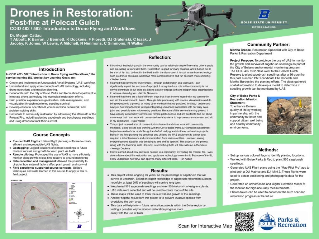
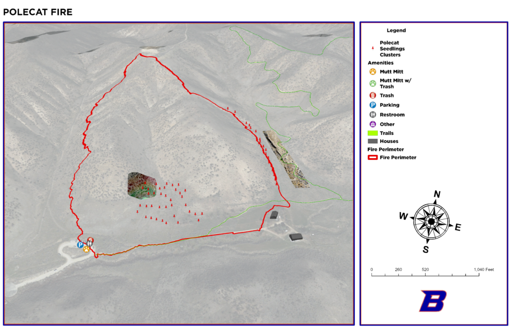
To prototype the use of UAS to monitor the growth and survival of sagebrush seedlings as part of the City of Boise’s environmental monitoring program. The COID 482 /582 class went to the Polecat Gulch Reserve to plant sagebrush seedlings after a 36-acre fire this past summer. Ph.D candidate Elle Horwath and Martha Barbec led the planting efforts. The class gathered spatial information to develop a model to determine if seedling growth can be monitored by UAS.
Course Concepts

- Planned UAS Flights: Utilized flight planning software to create efficient and reproducible UAS flights.
- Geotagging: Logged locations of planted seedlings to future monitor survival and growth for each plant via UAS
- Remote piloting: Prototyped the use of UAS to more efficiently monitor plant growth in less time relative to ground monitoring
- Data collection and management: Allowed the possibility to pinpoint how external factors affect plant growth and survival
- Field experience supported course concepts: Utilized techniques and skills learned in this course to apply to this SL field project.
Methods
- Set up various colored flags to identify planting locations.
- Worked with Boise Parks & Rec to plant 565 sagebrush seedlings.
- Generated UAS Flight plans using the “Map Pilot Pro” app to pilot both a DJI Matrice and DJI Mini 2. These flights were used to obtain positioning and photographic data for the project.
- Generated an orthomosaic and Digital Elevation Model of the location for high-accuracy measurements.
- Photos taken can be used to document the burn scar and restoration progress in the future.
Results
- This project will be ongoing for years, so the percentage of sagebrush that will survive is uncertain. Based on expert knowledge of sagebrush restoration success, hopefully, at least 20% of seedlings will survive long-term.
- We planted 565 sagebrush seedlings and over 50 bluebunch wheatgrass plants.
- UAS data were collected and will be used to create maps of the site.
- These maps will be used to track the survival and growth of the seedlings.
- Another hopeful result from this project is to prevent invasive species from overtaking the burn area.
- This data will help inform future restoration projects within the Boise region by testing a possible way to monitor restoration progress more easily with the use of UAS.