Integrating Behavioral Science and Evacuation Modeling to Improve Community Wildfire Resilience

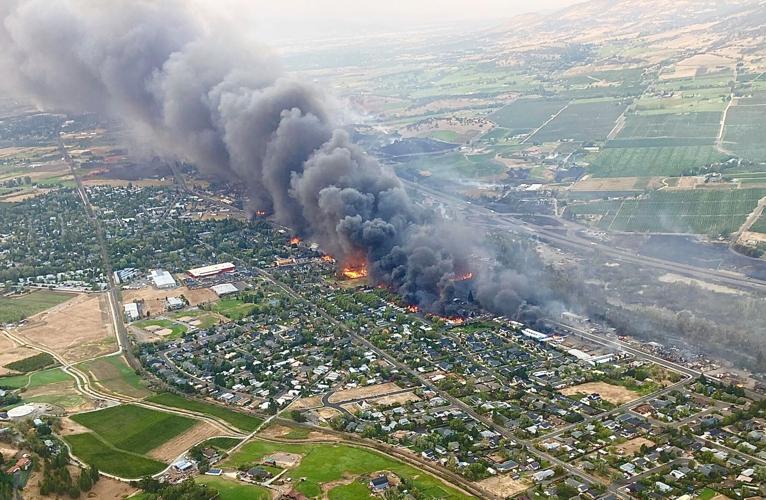
Over the past four decades, wildfire frequency and intensity have surged, doubling the average annual burn area. Rapid population expansion into the wildland-urban interface (WUI) exacerbates risks of human-caused ignition and damage to communities. Our project integrates behavioral science data and transportation engineering models to produce a convergent approach to wildfire risk reduction and, specifically, create more accurate and actionable interdisciplinary evacuation models. We are working with Ada County (Idaho) and the City of Ashland (Oregon) to (1) identify and validate the critical factors that influence household protective action decision making and evacuation logistics, and (2) integrate social-behavioral data into wildfire evacuation scenario simulations using agent-based models to assess evacuation efficacy. We translate our findings for emergency managers and the public through evidence based communication best practices to motivate a coordinated response and household protective action. Our findings will refine hazard education strategies, enhance community engagement and local authorities’ preparedness efforts and elicit a direct impact on communities by co-producing knowledge with community stakeholders, ensuring relevance and utility in our study areas.
Objectives
Objectives Include:
- Objective 1a: Assess how WUI residents’ wildfire experience, knowledge, and risk perceptions influence their hazard mitigation, stay and defend/survival preparedness, and evacuation readiness using a WUI-wide survey distributed across Idaho and Oregon.
- Objective 1b: Co-develop a wildfire scenario with community partners in Ada County, Idaho and the City of Ashland, Oregon using FlamMap. Use scenario to collect community partners’ decision points, decisions, and messaging. Using this information, co-develop a scenario story for local residents with our partner communities that includes fire details and evacuation messaging. Send scenario to residents along with a survey to assesses resident’s intended actions based on the scenario (stay and defend or evacuate, evacuation timing, routes, number of cars, etc).
- Objective 2: Integrate FlamMap outputs and behavioral data from emergency managers and community residents from objectives 1b into an interdisciplinary agent-based wildfire evacuation model for each study community. These models are a decision support tool that enable decision makers to explore decision timing and messaging on evacuation outcomes.
- Objective 3: Integrate findings from Objectives 1 and 2 to create and test community-informed, evidence-based education efforts for (1) emergency/fire managers, decision makers and land use planners, and (2) WUI residents.
People
- Michael Lindell, Emeritus Texas A&M University
- Haizhong Wang, Oregon State University
- Brittany D. Brand, Boise State University
- Ashley R. Bosa, Boise State University
- Chenqiang Liu, Oregon State University
- Louisa Wildman, Oregon State University
- Thomas J. Cova, University of Utah
Project Collaborators
- Paul Marusich, Ada County Office of Emergency Management and Community Resilience
- Kelly Burns, Emergency Management Coordinator for the City of Ashland, Oregon
- Chris Chambers, Forestry, Ashland Fire and Rescue

