Every winter, thousands of Idahoans wake up and check the snow levels at Bogus Basin. The ski resort, located 20 miles from downtown Boise, regularly posts photos of its snow marker, an upright measuring stick on top of a small platform. Every evening, staff come out and brush the platform clean so the tally can begin anew.
This rough measurement might be good enough for weekend warriors, but there’s more to snow levels than getting excited for the next powder day. Knowing how much snow and ice exists in Idaho’s mountains at a given moment is critical for farmers, rangeland administrators, water managers, flood and hydropower forecasters, anyone who lives along a river bank, and even the Department of Defense. These snow and ice measurements help anticipate growing seasons, make hydroelectric power forecasts and plan for deadly flooding.
But getting accurate snow measurements is difficult. Measuring sticks like the snow marker at Bogus Basin don’t account for snowpack density and seasonal changes thanks to melting and sublimation—the process of solid snow turning directly to vapor, which can happen below freezing.
What little information they do provide is limited to the immediate area around their platform, and snow levels can vary dramatically over the landscape. If a measurement is taken at one place in the Idaho wilderness, the snow levels could be very different just one football field’s length away.
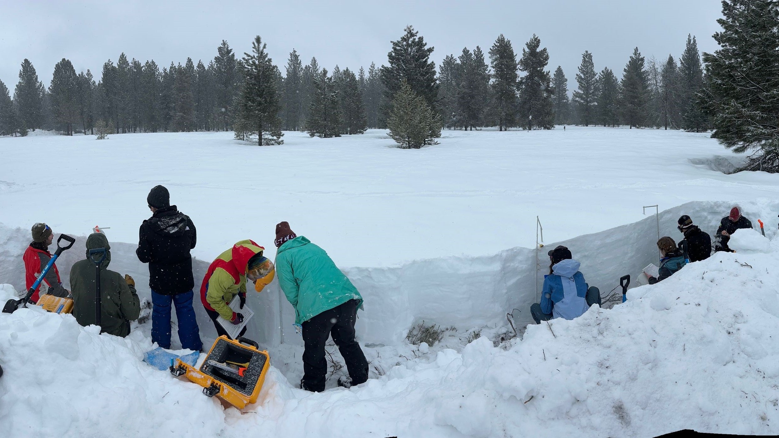
Researchers measuring snow properties in Idaho, like Boise State’s HP Marshall and his Cryosphere Geophysics and Remote Sensing (CryoGARS) group, have to rely on more involved methods. During the winter, the team spends many days every week out in the Idaho mountains, digging blocks out of the snow and taking detailed measurements of depth and density to estimate overall water content.
But Idaho’s mountain ranges are vast, and the team has to cover a lot of ground to get a good idea of how much snow they contain.
“It’s a total workout!” said Lindsay Stark, a geophysics Ph.D. student who Marshall supervises. “It’s fun though. You definitely feel good at the end of the day. When you open up a snow pit, you basically dig a three to six foot deep hole and then try and make it big enough for two people to comfortably work inside. So it’s a pretty big hole.”
Even with all their hard work, there are limits to how much field researchers can learn with traditional snow measuring techniques.
“In general we’re always undersampling the snow,” Marshall said. “We don’t know exactly how much there is in the mountains, since snow is only measured at relatively few locations, given the variability that exists.”
Fortunately, Marshall is developing new methods to enhance and expand field researchers’ capabilities and improve accuracy. This year, his team is deploying radar and lidar sensors in the Idaho mountains. The radar beam travels differently through snow than air. It also travels faster or slower depending on snow density. Marshall’s team can use the radar beam’s behavior to estimate snow depth and density, in combination with measurements on the ground.
Field researchers can deploy radar sensors on towers to measure continuously, or carry it while traveling on skis or a snowmobile, or with drones when they go out to dig in the snowpack. The drone can travel anywhere within the pilot’s line of sight, taking measurements the whole way. This lets the team multiply their effectiveness, as they compare information from the drone with the snow samples they’re digging up.
Marshall and collaborators from the U.S. Army Cold Regions Research and Engineering Lab and University of Massachusetts Amherst are deploying radar and lidar sensors on planes that will make regular flights over the Idaho mountains this winter. Chartering a plane is more expensive than drones, but it offers much more spatial coverage in much less time.
These new tools are a huge step up from traditional snow measurement techniques, but Marshall has his eyes set on even higher goals. He is currently working on proposals for a satellite-based sensor.
“Right now, we don’t have the ideal sensor in space,” he said. Today, satellite-based imaging can only answer one question: is there snow or not? But if Marshall and the snow community’s work pans out, we could have satellite-deployed sensors that produce snow water resource measurements for entire regions in a fraction of the time it takes a drone or plane.
Marshall thinks that the efforts of on-the-ground researchers will always be meaningful. But each new innovation—be it drone, plane or satellite sensors—makes those efforts more effective, and delivers dividends each spring when the snow begins to melt.