Visit Us!
Side-channel construction is complete, but our channel crossings have not yet been installed. We invite you to visit and take a walk along the greenbelt side of our Diane Moore Nature Center any time! Our grand re-opening with access to the river side of the nature center is expected by 2025.
We conduct habitat restoration activities year round at our river research station. To schedule a volunteer work day or habitat restoration activity with your company, school, or organization, email Heidi Ware Carlisle: HeidiWare@boisestate.edu
Our songbird banding station is open to the public on select dates from June to October. We offer drop-in dates for members of the public, as well as formal field trips for schools and groups. Visit our events page to see available dates.
About the Boise River Research Station
Please read these instructions carefully!
Our banding station at IBO’s Diane Moore Nature Center is located near the intersection of Warm Springs Avenue and the Highway 21 bridge, starting near the Diversion Dam and continuing over 1 mile downstream. The parking area is located here on google maps . The banding station is located on the south end of the nature center property just upstream of the highway 21 bridge (banding station here on google maps).
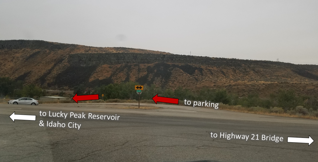
Approaching from Warm Springs Ave: From where Warm Springs Ave makes a T with Highway 21, drive straight across highway 21 (heading southwest) onto the gravel access road. Drive down toward the greenbelt (past chain link fenced area and “no access” signs) to reach the parking area.

Approaching from Highway 21:
From the west (Federal Way): Follow Highway 21 and cross the tall bridge over the Boise River. Immediately after the bridge, turn right onto the gravel access road and down toward the greenbelt (past chain link fenced area and “no access” signs) to reach the parking area.
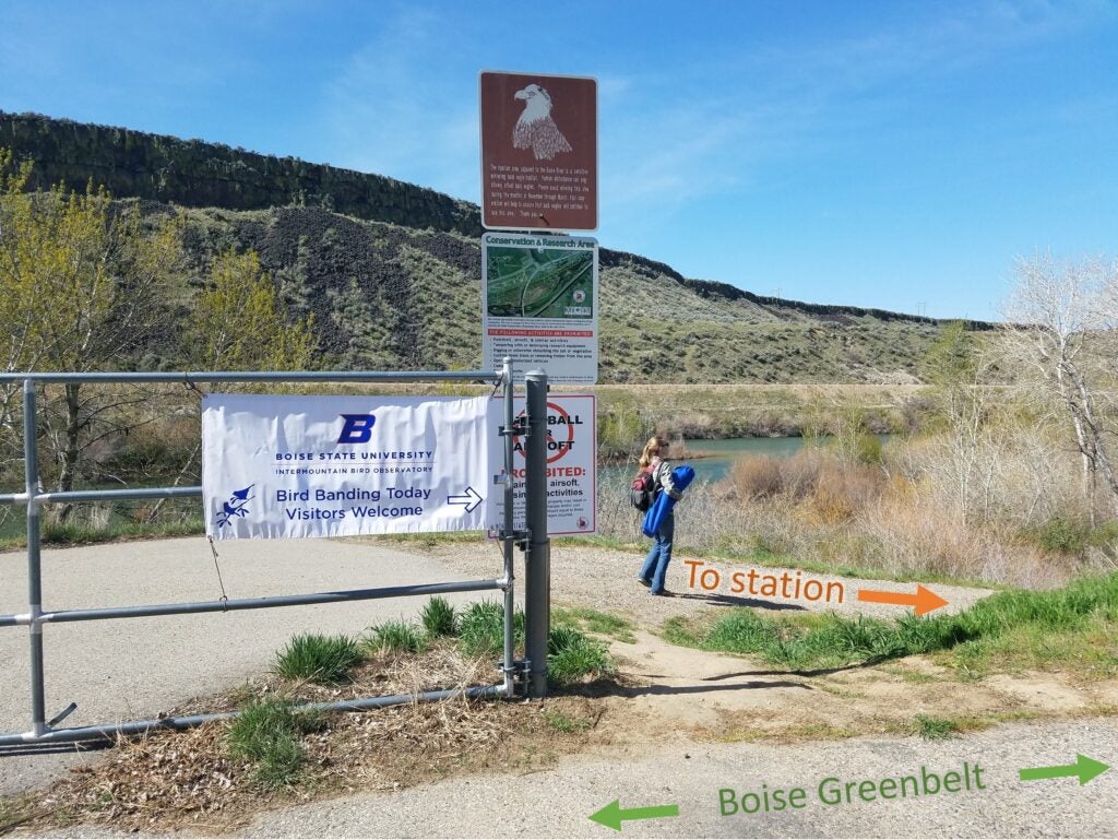
Both School buses and cars may park in the gravel parking area by the old dam turbine (red star on the map). Walk across the greenbelt and around the gates (there will be a “bird banding today” sign).

Follow the access road (orange on the map) down to the banding station (marked in purple). If parking is full, use the overflow parking area off of Warm Springs Ave. marked in green. Walk down the greenbelt to the orange access road.
You can click here to download a printable version of the Boise River Map to send to field trip participants.
Project Overview
IBO’s Diane Moore Nature Center makes hands-on-science opportunities similar to our Lucky Peak research station more widely available at an easily-accessible site that is open year-round.
We use these 20 acres of riverside habitat near the Barber Pool Conservation Area to provide research and education opportunities to students and families throughout the Treasure Valley.
Contact us
For questions or information about education programs and field trip activities:
Heidi Ware Carlisle—Education Director
208-426-2223
For information about construction and other updates email: GregoryKaltenecker@boisestate.edu