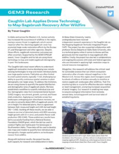
The November edition of the Idaho NSF EPSCoR Newsletter, the Researcher, featured student geo-admin Amy Johnson with her field work in the Mapping Sagebrush VIP.
Read about the article below!
“The work on mapping sagebrush recovery after wildfire by Trevor Caughlin and team, has led to an NSF EAGER award. Their GEM3 Vertically Integrated Project (VIP) is providing important training and WFD impact, while the research outcomes are supporting actionable science to inform ecosystem restoration.” -Andy Kliskey, Idaho EPSCoR Program Director
Caughlin Lab Applies Drone Technology to Map Sagebrush Recovery After Wildfire

Author: Trevor Caughlin
In Idaho and across the Western U.S., human activity has increased the occurrence of wildfires in the region, posing a severe threat to sagebrush, which cannot resprout after fire. Declining sagebrush cover has prompted large-scale restoration efforts by the Bureau of Land Management and other agencies. Despite these efforts, sagebrush restoration outcomes are often uncertain. Supported by the GEM3 EPSCOR award, Trevor Caughlin and his lab are using drone technology to map and model sagebrush demography in post-fire landscapes.
The Caughlin Lab’s most recent efforts to understand sagebrush restoration involve developing new remote sensing technologies to map and model individual plants over large spatial extents. Field plots are often limited to small spatial extents, typically <1 m², challenging our ability to quantify continuous spatial variation in plant demography over larger areas. To address this limitation, we are using drones to quantify the spatial distribution and demographic rates of sagebrush plants. We have established a workflow to quantify individual size and four demographic rates from Unmanned Aerial System (UAS) imagery: recruitment, growth, survival, and flower stalk production. Applying our methods across four landscapes undergoing post-disturbance recovery, we are able to correctly detect 89% of sagebrush plants >10 cm in height. For detected plants, there is agreement between field-measured height and UAS-derived height (R² = 0.69). Building off these results, we are able to measure survival of detected plants with 85% accuracy, height growth with 0.1 m error, and predict flower stalk production (R²=0.64). These preliminary results have led to successful funding from a National Science Foundation EAGER grant, which the lab has used to conduct flights over twelve post-fire landscapes in Southwestern Idaho. These data will be used to develop new maps and models to quantify how individual plant demography changes spatial patterns as landscapes recover from wildfire.
Along with technical results, the project has also built capacity for research and collaboration in Idaho.
At Boise State University, twenty undergraduates have received independent research experience in the Caughlin lab via the Mapping Sagebrush Vertically Integrated Project (VIP). The project has also supported collaboration with Professor Donna Delparte at Idaho State University, who is a technical genius when it comes to drones and has generously lent her expertise to map sagebrush after wildfire. Finally, the project has also led to collaborations and ongoing discussions with state and federal agencies who are interested in applying high-resolution maps to natural resource management.
Altogether, this research will address the critical need for actionable science that can inform ecosystem restoration after climate-induced megafires in the Western U.S. Across this region, land managers spend hundreds of millions of dollars annually to stabilize or restore sagebrush landscapes after wildfires. Post-fire monitoring data is crucial for effective decision-making on land management, prompting increased acquisition of aerial imagery. Our research is enabling new ways to acquire ecological information from remotely sensed data, including growth and survival rates of establishing plants.