Boise River Flow Budget
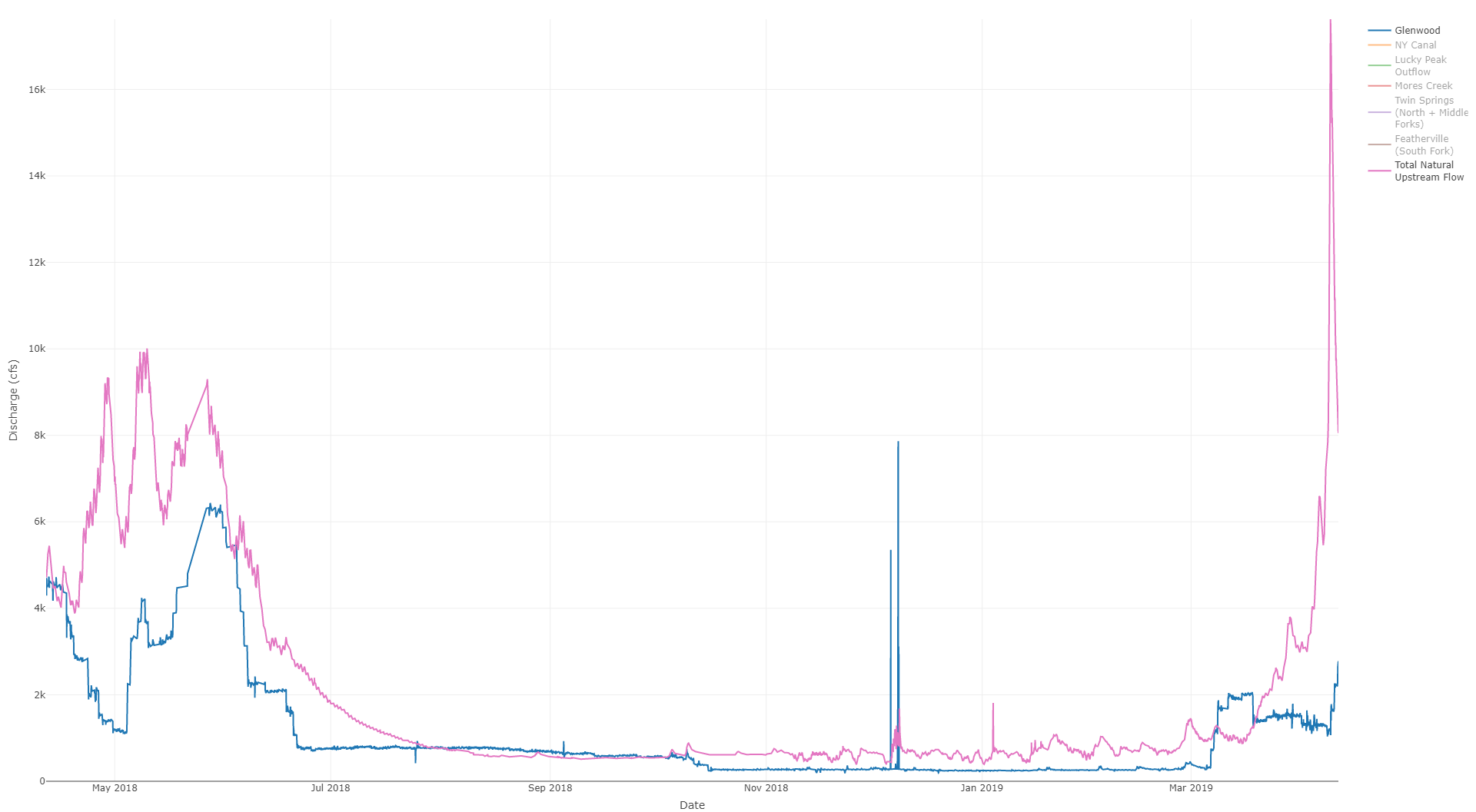
Discharge of various stream gages on the Boise river. The discharge of the river and canals is regulated below Lucky Peak. “Natural flow” is the sum of the (unregulated) tributary flows. Discharge and storage data are taken from various US Bureau of Reclamation stream gages available at the hydromet web site.
Boise River Reservoir Storage
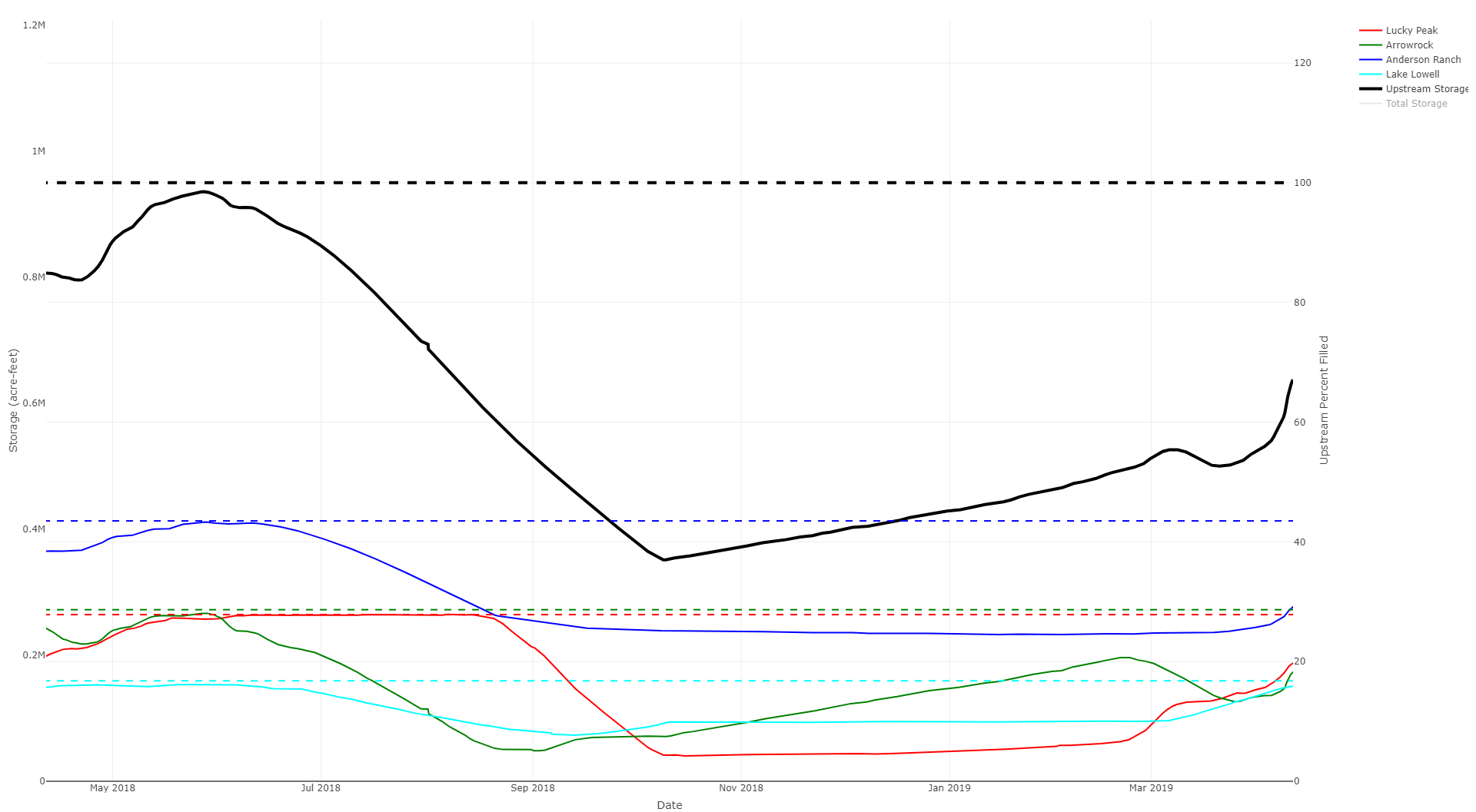
Storage in reservoirs in the Boise river basin. Dashed lines represent reservoir capacity (for example, the dashed blue line represents the 413100 acre-foot capacity of Anderson Ranch lake). “Upstream Storage” is defined as the sum of Lucky Peak, Arrowrock, and Anderson Ranch lakes.
Boise Basin Gage Map
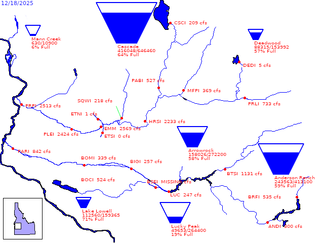
Map and current readings of reservoir and streamflow gages in the Boise and Payette basins (taken from US Bureau of Reclamation Hydromet site).
Boise River Basin Snowpack
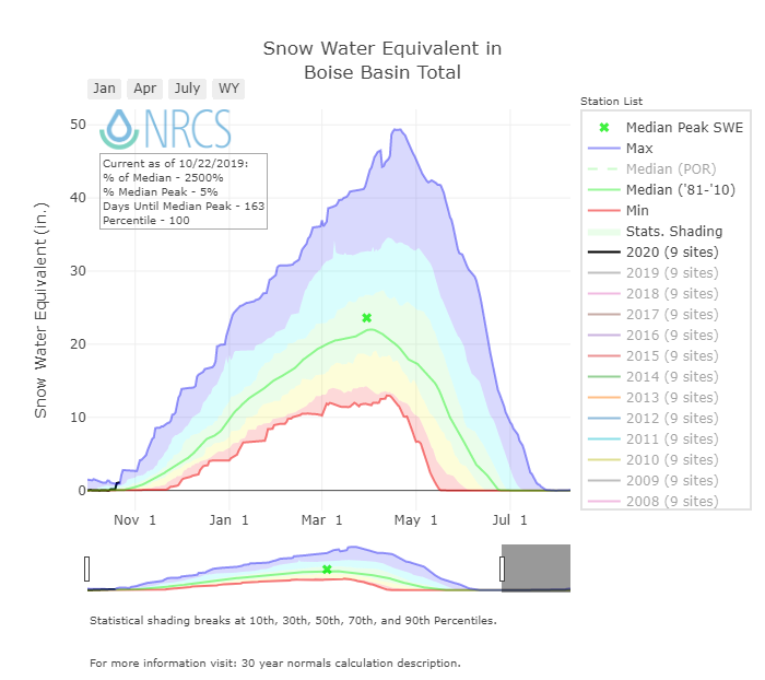
SWE estimated from SNOTEL sites in the Boise basin. Plot available from NRCS.
More SNOTEL data available through this interactive map.
Idaho Snow Water Equivalent by Basin
Click this Link to view Idaho Snow Water Equivalent by Basin
Idaho Year-to-Date Precipitation by Basin
Click this Link to view Idaho Year-to-Date Precipitation by Basin
Western US Snow Water Equivalent by Basin
Click this Link to view Western US Snow Water Equivalent by Basin
Western US Year-to-Date Precipitation by Basin
Click this Link to view Western US Year-to-Date Precipitation by Basin
Boise River Park WaveShaper Cam
Live webcam of Boise River Park wave (courtesy of Boise City Parks & Recreation).
Bogus Basin Webcam
Live webcam of Bogus Basin (Bogus Basin Website).