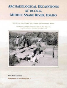
Monographs in Archaeology, Volume No. 3
by Mark G. Plew, Sharon Plager, Tedd D. Jacobs, and Christopher A. Willson with contributions by Tedd D. Jacobs, LeAnn Schuster, Nicki McDonald, Craig Skinner, Darden Hood, and Christopher L. Hill
ISBN: 0-99779515-0-2 (2006)
143 pp.
Cost $21.95
Purchase Monographs in Archaeology, Volume No. 3
Introduction
During the summers of 2002, 2003, 2004, and 2005, test excavations were conducted at site 10-CN-6 located on the Snake River approximately 5 miles south of Melba, Idaho. The excavations were conducted by Boise State University as part of its Archaeological Field School in cooperation with Celebration Park Interpretive Center and Canyon County Parks, Recreation, and Waterways. Site 10-CN-6 is located within Celebration Park about halfway between the Interpretive Center and the historic Guffey Railroad Bridge. the site is situated on a steppe terrace which extends approximately 100 m north of the Snake River within a desert-riverine setting consisting of short grasses, small to medium sagebrush, and greasewood. A distinct geomorphic feature of basalt boulders deposited by the Bonneville Flood borders the terrace along the western and northern ridges.
Site 10-CN-6 was originally recorded and surveyed by Tuohy (1958), later by Keeler and Koko (1971) and more recently by Murphey (1977). Tuohy described the site as a “campsite,” noting mussel shell and lithic debris. He suggested that the site might be an extension of 10-CN-5 which was recorded to the east. when conducting survey for the proposed Guffey Falls dam project, Keeler and Koko reported that 10-CN-5 and j10-CN-6 were continuous sites. they noted extensive looting in the area and found shell, lithics, and metates in the looters’ backfill dirt. The Bureau of Land Management (BLM) archaeological survey was conducted by Murphey. Murphey described the area as a habitation site and reported sites 10-CN-5 and 10-CN-6 on the same record form. He noted mussel shells, fire-cracked rock, two hand stones, and looters’ pits as deep as 1.5 m.
Site 10-CN-6 was initially tested by Dr. T. Virginia Cox and students from Boise State College in 1968 (Hauer and Hughes 1996). At the time, the site was privately owned by John Warwick and was labeled the Warwick site. Warwick indicated to Cox that “the previous owner had uncovered approximately 5,000 artifacts before selling the land” and agreed to excavation. The excavations were conducted just west of the house foundation.
The results of the 1968 excavation were recently summarized and reported by Hauer and Hughes (1996). The excavation recovered only a limited number of artifacts. The field notes and provenience data recorded on artifact bags had faded over 30 years’ time and much of the information was lost. Residue analysis yielded inconclusive results. Based on the presence of Elko and Desert Side-Notched projectile points and Shoshoni Ware pot sherds, their summary indicated a possible multi-component site occupied ca. 5,000-900 BP. The diverse tool assemblage of knives, groundstone, bifaces, scrapers, projectile points and pottery sherds led them to believe site 10-CN-6 was “a short-term habitation site characterized by a rather generalized assemblage” (Hauer and Hughes 1996:24).
Boise State University initiated further investigations in 2002 to evaluate more extensively the archaeological record, in particular the age and variation in technological organization. We hoped to confirm whether or not site 10-CN-6 was utilized on multiple occasions and at different times. XRF analysis was conducted to determine sources of obsidian toolstone. Shovel probes in 2003 and test units in 2004 revealed the extent of the site’s boundaries indicating the spatial division between site 10-CN-6 and 10-CN-5. In 2004 and 2005, we investigated whether artifacts were washing down from possible deposits among the boulders along the site’s western perimeter. Additionally, recovered cultural materials serve to increase the baseline data relating to Archaic sites in the area.
Table of Contents
Download Table of Contents (PDF)
- List of Figures – iii
- List of Tables – v
- Acknowledgments – vii
- Introduction – 1
- Environmental Setting – 2
- Previous Archaeological Research – 4
- Problem Orientation -12
- Field Methods – 14
- Nature of Deposits/Culture Features – 15
- Sediment Analysis – 15
- Archaeological Features – 17
- Material Culture Remains – 20
- Artifact Analysis – 20
- Lithic Artifacts – 20
- Projectile Points – 21
- Ceramics – 34
- Historic Artifacts – 34
- Assemblage Analysis Summary – 38
- Discussion – 39
- Lithic Debitage Analysis – 40
- Faunal Remains – 44
- Summary and Implications – 45
- Research Questions from the 2002 Field Season – 45
- Research Questions for the 2003 Field Season – 47
- Research Questions for the 2004 and 2005 Field Seasons – 48
- General Conclusions – 49
- References Cited – 51
- Appendix I: Distribution of Ecofactual Material, 10-CN-6, 2002-2005 – 57
- Appendix II: Analysis of Sediments, 10-CN-6 Tedd D. Jacobs – 75
- Appendix III: Analysis of Faunal Remains, 2002, 10-CN-6 LeAnn Schuster – 89
- Appendix IV: Analysis of Faunal Remains, 2003, 10-CN-6 Nicki McDonald – 95
- Appendix V: XRF Analysis of Obsidian Artifacts, 2002, 10-CN-6 Craig Skinner – 103
- Appendix VI: XRF Analysis of Obsidian Artifacts, 2003, 10-CN-6 Craig Skinner – 109
- Appendix VII: Radiocarbon Dating Result for Sample 10-CN-6 Darden Hood – 113
- Appendix VIII: Late Tertiary to Quaternary Geology and Landscape Evolution along the Western Snake River Plain, Southwestern Idaho Christopher L. Hill – 123